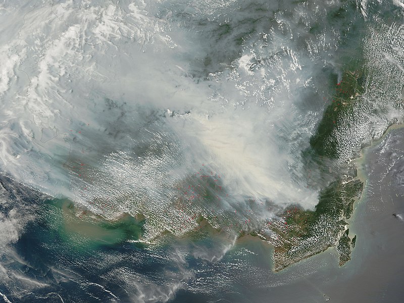
Datoteka:Borneo fires October 2006.jpg
Izgled

Veličina ovog prikaza: 800 × 600 piksela. Ostale razlučivosti: 320 × 240 piksela | 640 × 480 piksela | 1.024 × 768 piksela | 1.280 × 960 piksela | 2.560 × 1.920 piksela | 4.000 × 3.000 piksela.
Vidi sliku u punoj veličini (4.000 × 3.000 piksela, veličina datoteke: 1,94 MB, MIME tip: image/jpeg)
Povijest datoteke
Kliknite na datum/vrijeme kako biste vidjeli datoteku kakva je tada bila.
| Datum/Vrijeme | Minijatura | Dimenzije | Suradnik | Komentar | |
|---|---|---|---|---|---|
| sadašnja | 10:30, 9. listopada 2006. |  | 4.000 × 3.000 (1,94 MB) | NSLE-Chacor | {{Information |Description= Fires on Borneo Thick smoke hung over the island of Borneo when the Moderate Resolution Imaging Spectroradiometer (MODIS) on NASA’s Terra satellite passed overhead on October 5, 2006. The sensor detected scores of fires (loc |
Uporaba datoteke
Na ovu sliku vode poveznice sa sljedećih stranica:
Globalna uporaba datoteke
Sljedeći wikiji rabe ovu datoteku:
- Uporaba na ar.wikipedia.org
- Uporaba na as.wikipedia.org
- Uporaba na ba.wikipedia.org
- Uporaba na bn.wikipedia.org
- Uporaba na ca.wikipedia.org
- Uporaba na de.wikipedia.org
- Uporaba na en.wikipedia.org
- Uporaba na en.wikinews.org
- Uporaba na es.wikipedia.org
- Uporaba na fa.wikipedia.org
- Uporaba na ha.wikipedia.org
- Uporaba na id.wikipedia.org
- Uporaba na ig.wikipedia.org
- Uporaba na it.wikipedia.org
- Uporaba na mn.wikipedia.org
- Uporaba na ms.wikipedia.org
- Uporaba na ru.wikipedia.org
- Uporaba na sh.wikipedia.org
- Uporaba na sr.wikipedia.org
- Uporaba na th.wikipedia.org
- Uporaba na uk.wikipedia.org
- Uporaba na ur.wikipedia.org
- Uporaba na uz.wikipedia.org
- Uporaba na vi.wikipedia.org
Pogledajte globalnu uporabu ove datoteke.


