
Datoteka:Zarit incident map.png

Viša rezolucija nije dostupna.
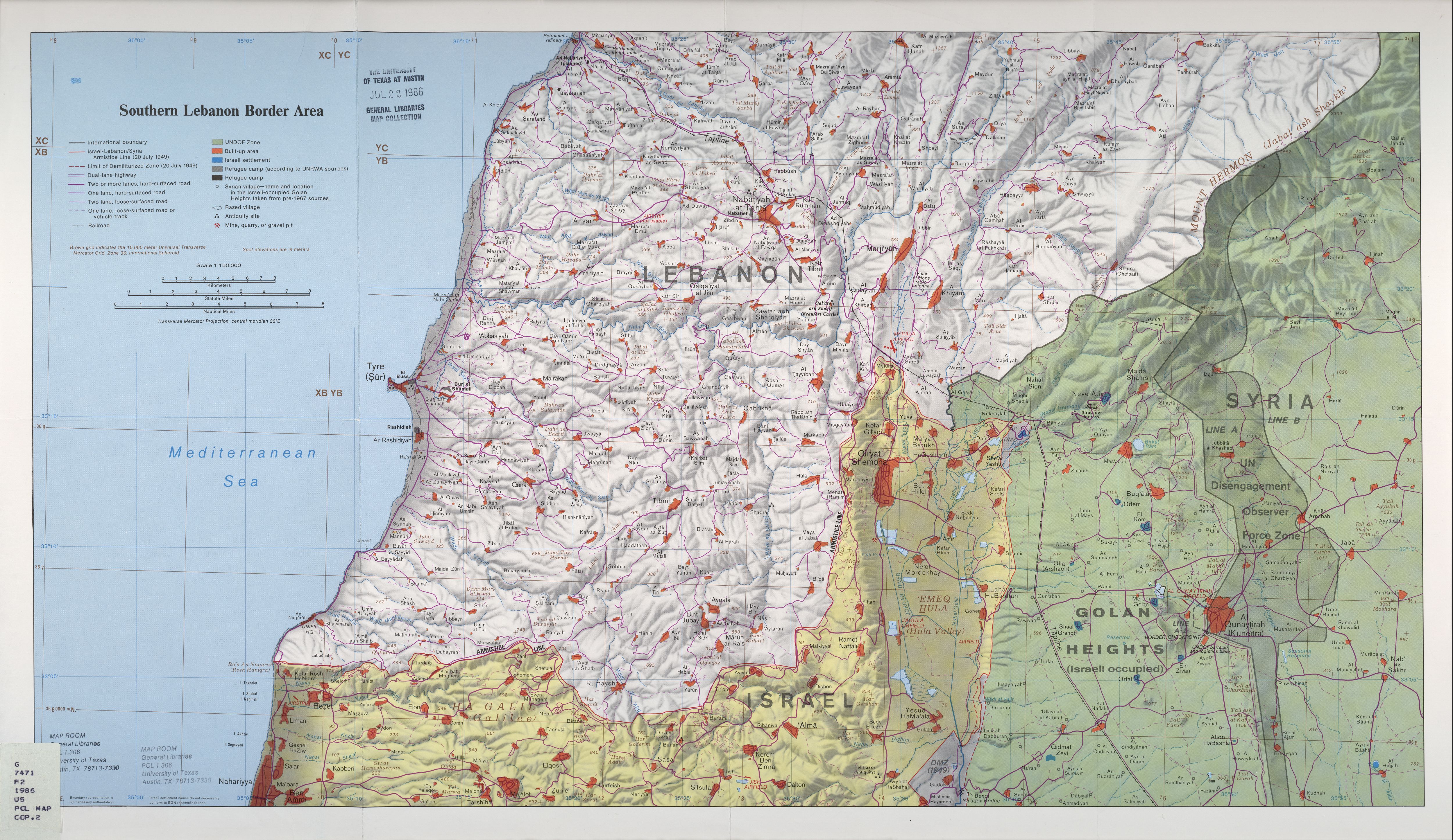
Zarit_incident_map.png (519 × 298 piksela, veličina datoteke: 67 KB, MIME tip: image/png)
| Ova je datoteka sa Zajedničkog poslužitelja i mogu je rabiti drugi projekti. Opis s njezine stranice s opisom datoteke prikazan je ispod. |
| Opis | Map of Zar'it and vicinity illustrating the localities involved in the Zar'it-Ayta ash-Shab incident which sparked the 2006 Israel-Lebanon conflict. |
| Datum | Incident happened on July 12 2006. Upload August 17 2006. |
| Izvor | Uploaded as en:Image:Zarit incident map.png. Based on http://www.lib.utexas.edu/maps/middle_east_and_asia/lebanon_southern_border_1986.jpg |
| Autor | Original map is the work of the Central Intelligence Agency. Modifications by en:User:ChrisO. |
| Dopuštenje (Naknadna uporaba ove datoteke) |
PD |
| This image is a work of a Central Intelligence Agency employee, taken or made as part of that person's official duties. As a Work of the United States Government, this image or media is in the public domain in the United States.
|

|
Povijest datoteke
Kliknite na datum/vrijeme kako biste vidjeli datoteku kakva je tada bila.
| Datum/Vrijeme | Minijatura | Dimenzije | Suradnik | Komentar | |
|---|---|---|---|---|---|
| sadašnja | 01:58, 20. kolovoza 2006. | | 519 × 298 (67 KB) | Jkelly | {{Information |Description=Map of Zar'it and vicinity illustrating the localities involved in the Zar'it-Ayta ash-Shab incident which sparked the 2006 Israel-Lebanon conflict. |Source=Uploaded as en:Image:Zarit incident map.png. Based on htt |
Uporaba datoteke
Na ovu sliku vode poveznice sa sljedećih stranica:
Globalna uporaba datoteke
Sljedeći wikiji rabe ovu datoteku:
- Uporaba na ar.wikipedia.org
- Uporaba na azb.wikipedia.org
- Uporaba na bn.wikipedia.org
- Uporaba na de.wikipedia.org
- Uporaba na en.wikipedia.org
- Uporaba na no.wikipedia.org
- Uporaba na pl.wikipedia.org
- Uporaba na pt.wikipedia.org
- Uporaba na ro.wikipedia.org
- Uporaba na sh.wikipedia.org
- Uporaba na sk.wikipedia.org
- Uporaba na www.wikidata.org